
+7
11
Dromdeeveen, Ashford, Co. Limerick
€210,000
54.15 ac
Agricultural Land
Property Overview
- Available From: Immediately
Description
- Sale Type: For Sale by Private Treaty
- Overall Floor Area: 54.15 ac
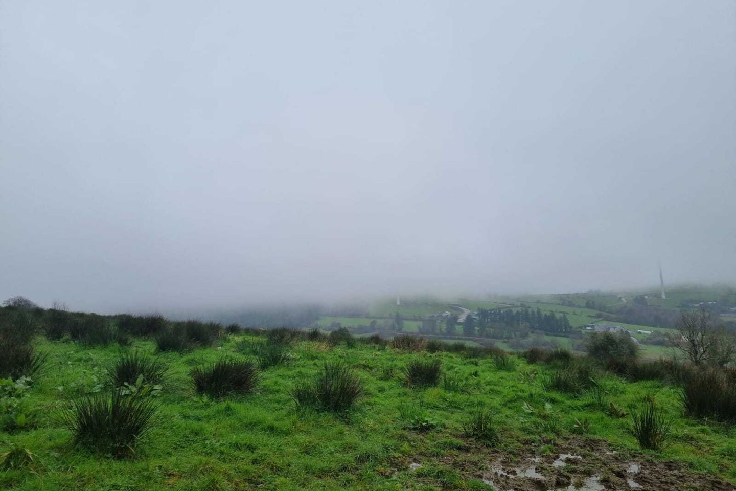
DNG Declan Woulfe are delighted to offer circa 54.15 acres of mixed non-residential agricultural holding contained in folios LK27089, LK39432F, LK1479F, LK27022 and LK1480F located approximately 5kms from the village of Broadford with the county town of Newcastle West a further 16kms away. This expansive holding is located off a local secondary road, the land is ideal for a variety of purposes. Circa 41.8 acres of the lands are designated Hen Harrier SPA with circa 12.35 acres being non Hen Harrier SPA.
The lands are located near V42 W998.
For maps and further information, please contact the sole selling agent DNG Declan Woulfe
Map
Map
Local AreaNEW

Learn more about what this area has to offer.
School Name | Distance | Pupils | |||
|---|---|---|---|---|---|
| School Name | Ashford National School | Distance | 3.5km | Pupils | 20 |
| School Name | Broadford National School | Distance | 4.5km | Pupils | 159 |
| School Name | Raheenagh National School | Distance | 4.7km | Pupils | 80 |
School Name | Distance | Pupils | |||
|---|---|---|---|---|---|
| School Name | Tullylease National School | Distance | 6.5km | Pupils | 27 |
| School Name | Meelin National School | Distance | 7.7km | Pupils | 56 |
| School Name | Rockchapel National School | Distance | 8.8km | Pupils | 31 |
| School Name | Dromcollogher Primary School | Distance | 8.9km | Pupils | 73 |
| School Name | Glengurt National School | Distance | 9.4km | Pupils | 111 |
| School Name | Monagea National School | Distance | 10.0km | Pupils | 225 |
| School Name | Mahoonagh National School | Distance | 10.9km | Pupils | 229 |
School Name | Distance | Pupils | |||
|---|---|---|---|---|---|
| School Name | Hazelwood College | Distance | 8.8km | Pupils | 600 |
| School Name | Scoil Mhuire & Íde | Distance | 12.6km | Pupils | 760 |
| School Name | Desmond College | Distance | 13.6km | Pupils | 465 |
School Name | Distance | Pupils | |||
|---|---|---|---|---|---|
| School Name | Coláiste Íde Agus Iosef | Distance | 18.8km | Pupils | 679 |
| School Name | Scoil Mhuire | Distance | 19.2km | Pupils | 303 |
| School Name | Boherbue Comprehensive School | Distance | 19.5km | Pupils | 436 |
| School Name | Coláiste Treasa | Distance | 19.6km | Pupils | 599 |
| School Name | Colaiste Na Trocaire (mercy Community College) | Distance | 21.7km | Pupils | 493 |
| School Name | St. Mary's Secondary School | Distance | 23.6km | Pupils | 252 |
| School Name | C.b.s. Charleville | Distance | 24.1km | Pupils | 240 |
Type | Distance | Stop | Route | Destination | Provider | ||||||
|---|---|---|---|---|---|---|---|---|---|---|---|
| Type | Bus | Distance | 7.0km | Stop | St. Mary's Church | Route | 521 | Destination | Sheehan's Road | Provider | Tfi Local Link Limerick Clare |
| Type | Bus | Distance | 7.0km | Stop | St. Mary's Church | Route | 521 | Destination | Dooley's Supermarket | Provider | Tfi Local Link Limerick Clare |
| Type | Bus | Distance | 7.0km | Stop | St. Mary's Church | Route | 521 | Destination | Charleville | Provider | Tfi Local Link Limerick Clare |
Type | Distance | Stop | Route | Destination | Provider | ||||||
|---|---|---|---|---|---|---|---|---|---|---|---|
| Type | Bus | Distance | 7.0km | Stop | St. Mary's Church | Route | 521 | Destination | St. Joseph's Church | Provider | Tfi Local Link Limerick Clare |
| Type | Bus | Distance | 8.5km | Stop | Dromcollogher | Route | 521 | Destination | Dooley's Supermarket | Provider | Tfi Local Link Limerick Clare |
| Type | Bus | Distance | 8.5km | Stop | Dromcollogher | Route | 521 | Destination | Sheehan's Road | Provider | Tfi Local Link Limerick Clare |
| Type | Bus | Distance | 8.5km | Stop | Dromcollogher | Route | 521 | Destination | St. Joseph's Church | Provider | Tfi Local Link Limerick Clare |
| Type | Bus | Distance | 8.5km | Stop | Dromcollogher | Route | 521 | Destination | Charleville | Provider | Tfi Local Link Limerick Clare |
| Type | Bus | Distance | 10.8km | Stop | Community Centre | Route | 521 | Destination | Charleville | Provider | Tfi Local Link Limerick Clare |
| Type | Bus | Distance | 10.8km | Stop | Community Centre | Route | 521 | Destination | Sheehan's Road | Provider | Tfi Local Link Limerick Clare |
BER Details

Statistics
15/04/2024
Entered/Renewed
654
Property Views
Daft ID: 519290524
Contact Agent

Declan Woulfe
068 32141/ 087 7617573