
10-11 Deansgrange Business Park, Deansgrange, Co. Dublin
Rent Negotiable
- Unit Price:€0.00 per sq. m per year
- Available From:Immediately
About 10-11 Deansgrange Business Park, Deansgrange
Description
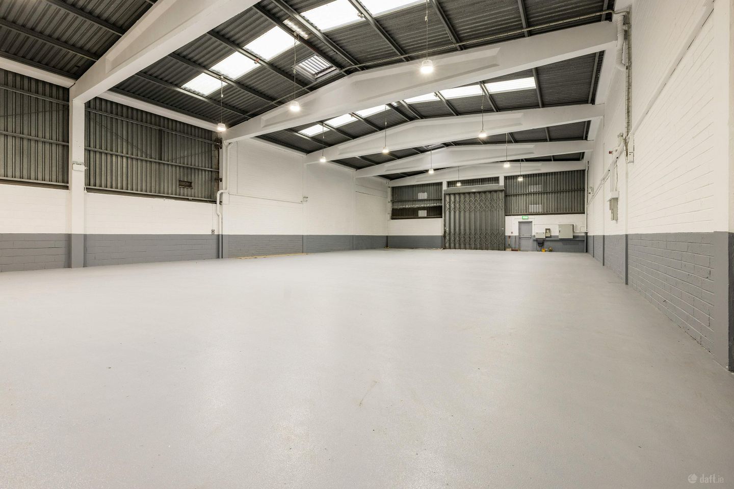
The subject property comprises 2 x high-quality industrial units with 2-storey offices to the front. Unit 10: c. 587 sq. m. / 6,316 sq. ft. Unit 11: c. 570 sq. m. / 6,141 sq. ft. The units can be let together or separately. The property extends to c. 1,157 sq. m. / 12,457 sq. ft. with ample car parking spaces. The space comprises c. 908 sq. m. / 9,779 sq. ft. of warehouse accommodation, with the remainder being office space. The warehouse is accessed via 2 x full-height roller shutter doors. The offices comprise a mix of open-plan and cellular offices. There is a small yard area to the front of the unit. The building has the benefit of 24 car parking spaces. Additional car spaces are available. The unit is under a full refurbishment programme and will be ready for occupation in April 2026. The property presents in turnkey condition for any occupiers seeking new accommodation. Deansgrange Business Park is a well-established commercial and industrial hub located in South County Dublin. The park's location offers immediate access to major arterial routes and transportation hubs. It is located roughly 1 km from the N11 (Stillorgan Dual Carriageway), a primary route connecting the city centre to the southeast. The M50 motorway is less than 5.5 km away, providing links to Dublin Airport and the national motorway network. The area is served by several Dublin Bus and Go-Ahead Ireland routes (e.g., E2, L25, L26, and 46A), with stops located directly on Kill Lane at the front of the park. Other occupiers in the area include Baxter Healthcare, The Panelling Centre, Nesta and Office Supplies Ireland. Viewing by Appointment Only - Please contact Quinn Agnew New Lease - Flexible Lease Terms Available Key Points: - High Quality Industrial Unit - Fully Refurbished Building - c. 1,157 sq. m. / 12, 457 sq. ft. - 2 x Roller Shutter Doors - Excellent Transport Links
The local area of 10-11 Deansgrange Business Park, Deansgrange
Local schools and transport

Learn more about what this area has to offer.
School Name | Distance | Pupils | |||
|---|---|---|---|---|---|
| School Name | Kill O' The Grange National School | Distance | 80m | Pupils | 208 |
| School Name | Gaelscoil Laighean | Distance | 250m | Pupils | 105 |
| School Name | National Rehabilitation Hospital | Distance | 670m | Pupils | 10 |
School Name | Distance | Pupils | |||
|---|---|---|---|---|---|
| School Name | Monkstown Etns | Distance | 730m | Pupils | 427 |
| School Name | Hollypark Boys National School | Distance | 970m | Pupils | 512 |
| School Name | Hollypark Girls National School | Distance | 990m | Pupils | 487 |
| School Name | Holy Family School | Distance | 1.0km | Pupils | 153 |
| School Name | Red Door Special School | Distance | 1.1km | Pupils | 30 |
| School Name | Dún Laoghaire Etns | Distance | 1.1km | Pupils | 177 |
| School Name | St Brigid's Girls School | Distance | 1.2km | Pupils | 509 |
School Name | Distance | Pupils | |||
|---|---|---|---|---|---|
| School Name | Clonkeen College | Distance | 960m | Pupils | 630 |
| School Name | Rockford Manor Secondary School | Distance | 990m | Pupils | 285 |
| School Name | Loreto College Foxrock | Distance | 1.2km | Pupils | 637 |
School Name | Distance | Pupils | |||
|---|---|---|---|---|---|
| School Name | Newpark Comprehensive School | Distance | 1.5km | Pupils | 849 |
| School Name | Christian Brothers College | Distance | 1.5km | Pupils | 564 |
| School Name | Holy Child Community School | Distance | 1.6km | Pupils | 275 |
| School Name | Cabinteely Community School | Distance | 2.0km | Pupils | 517 |
| School Name | Rathdown School | Distance | 2.1km | Pupils | 349 |
| School Name | St Joseph Of Cluny Secondary School | Distance | 2.6km | Pupils | 256 |
| School Name | Nord Anglia International School Dublin | Distance | 2.8km | Pupils | 630 |
Type | Distance | Stop | Route | Destination | Provider | ||||||
|---|---|---|---|---|---|---|---|---|---|---|---|
| Type | Bus | Distance | 190m | Stop | Clonkeen Road | Route | L26 | Destination | Kilternan | Provider | Go-ahead Ireland |
| Type | Bus | Distance | 190m | Stop | Clonkeen Road | Route | 84n | Destination | Charlesland | Provider | Nitelink, Dublin Bus |
| Type | Bus | Distance | 220m | Stop | Kill Abbey | Route | E2 | Destination | Dun Laoghaire | Provider | Dublin Bus |
Type | Distance | Stop | Route | Destination | Provider | ||||||
|---|---|---|---|---|---|---|---|---|---|---|---|
| Type | Bus | Distance | 240m | Stop | Deansworth | Route | L26 | Destination | Blackrock | Provider | Go-ahead Ireland |
| Type | Bus | Distance | 280m | Stop | Deansgrange Village | Route | E2 | Destination | Harristown | Provider | Dublin Bus |
| Type | Bus | Distance | 300m | Stop | Clonkeen Crescent | Route | L27 | Destination | Dun Laoghaire | Provider | Go-ahead Ireland |
| Type | Bus | Distance | 360m | Stop | Holy Family Church | Route | E2 | Destination | Harristown | Provider | Dublin Bus |
| Type | Bus | Distance | 380m | Stop | Abbey Road | Route | 7d | Destination | Mountjoy Square | Provider | Dublin Bus |
| Type | Bus | Distance | 380m | Stop | Abbey Road | Route | 7b | Destination | Mountjoy Square | Provider | Dublin Bus |
| Type | Bus | Distance | 380m | Stop | Abbey Road | Route | L27 | Destination | Dun Laoghaire | Provider | Go-ahead Ireland |
BER Details
Ad performance
- Date listed30/03/2026
- Views574
Daft ID: 56532481