
Building N, Central Park, D18 AC2C, Dublin 18
Rent Negotiable
- Unit Price:€0.00 per sq. m per year
- Available From:Immediately
About Building N, Central Park
Description
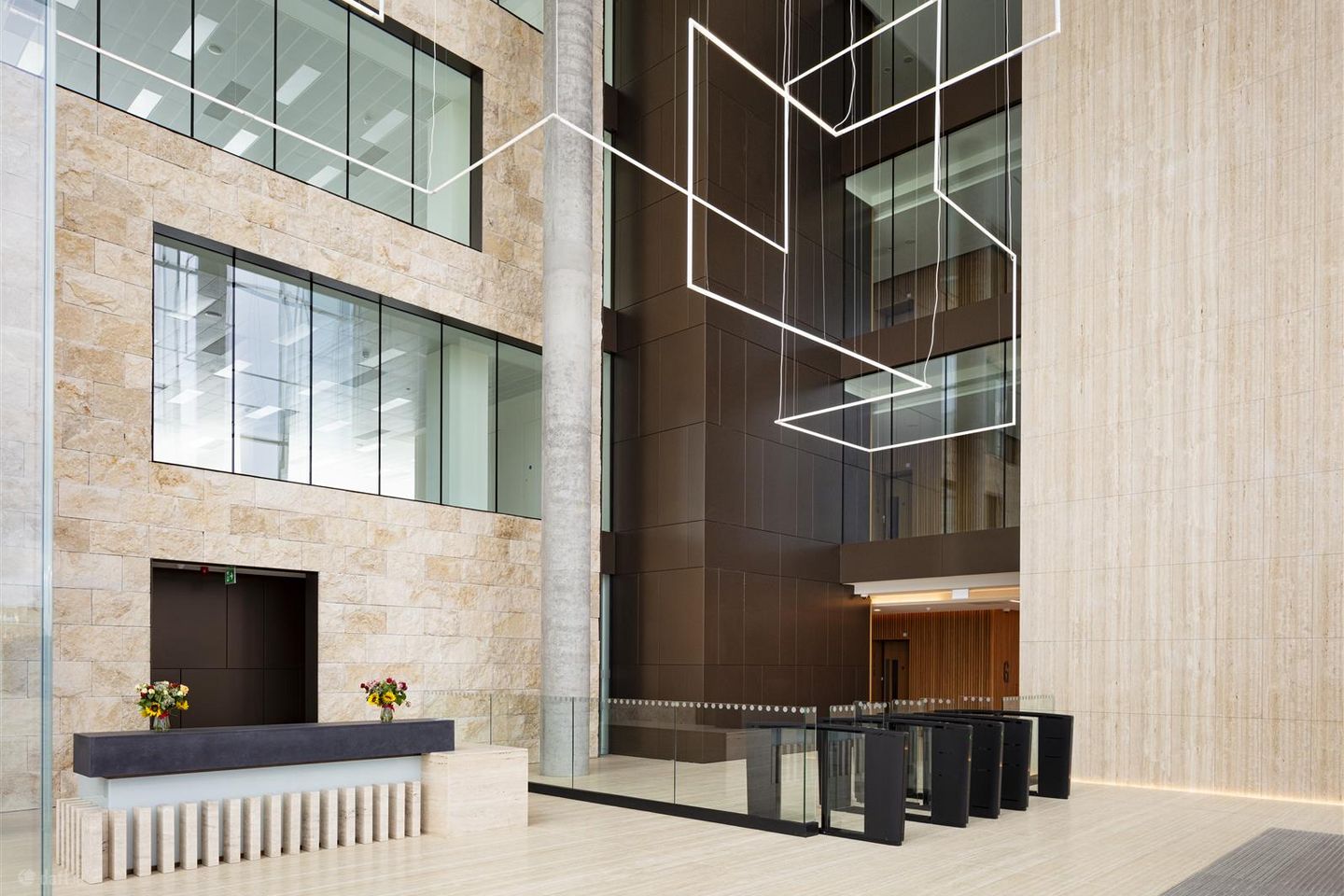
The proposed development consists of three separate, or potentially interconnected, office buildings: N1, N2 and N3 which step in height across the site. The arrangement, form and appearance of the three buildings are designed to present a cohesive and coherent overall composition while at the same time providing individual character and identity to each building. The office accommodation is located across 9 floors, from garden to roof level. The buildings face onto a large new landscaped park which will provide varied and extensive public amenity and civic space for the residents, tenants and visitors to Central Park. The entrances to the buildings are congregated around a shared entry plaza which is accessed through the new park. The development also includes a wellness pavilion over a shared lower ground and basement car park. The layout of the buildings is designed to allow provision for the planned new road link along the western boundary of the site, adjacent to the M50. Building N1 is currently under construction and will provide 204,428 sq. ft of Grade A office accommodation which will reach practical completion in Q3 2023. Building N is located within the Central Park business campus in Leopardstown and is the latest part of the overall masterplan which was granted initial planning permission in 1999. Central Park has been steadily developed over the intervening 23 years in accordance with the original permission and high-quality pedestrian and public spaces amendment permissions and now contains a mixture of office, apartments, hotel, creche, and retail, including a restaurant building. A double level basement car park, with multiple access points, extends beneath the entire site. The Building N site is located at the southern end of Central Park, it is connected to the southwest by the M50 and to the southeast by the LUAS line and the Leopardstown Park Hospital beyond. The northeast boundary of the site is formed by an existing access road that serves the adjacent apartments and offices which will provide access to the proposed development.
Standard features
The local area of Building N, Central Park
Local schools and transport

Learn more about what this area has to offer.
School Name | Distance | Pupils | |||
|---|---|---|---|---|---|
| School Name | Grosvenor School | Distance | 220m | Pupils | 68 |
| School Name | Holy Trinity National School | Distance | 1.1km | Pupils | 596 |
| School Name | Goatstown Stillorgan Primary School | Distance | 1.1km | Pupils | 141 |
School Name | Distance | Pupils | |||
|---|---|---|---|---|---|
| School Name | St Raphaela's National School | Distance | 1.3km | Pupils | 408 |
| School Name | Gaelscoil Thaobh Na Coille | Distance | 1.4km | Pupils | 409 |
| School Name | Queen Of Angels Primary Schools | Distance | 1.6km | Pupils | 252 |
| School Name | Setanta Special School | Distance | 1.7km | Pupils | 65 |
| School Name | St Brigids National School | Distance | 1.8km | Pupils | 102 |
| School Name | Gaelscoil Shliabh Rua | Distance | 1.8km | Pupils | 348 |
| School Name | Stepaside Educate Together National School | Distance | 1.8km | Pupils | 514 |
School Name | Distance | Pupils | |||
|---|---|---|---|---|---|
| School Name | Nord Anglia International School Dublin | Distance | 500m | Pupils | 630 |
| School Name | St Raphaela's Secondary School | Distance | 1.4km | Pupils | 631 |
| School Name | Loreto College Foxrock | Distance | 1.8km | Pupils | 637 |
School Name | Distance | Pupils | |||
|---|---|---|---|---|---|
| School Name | Rosemont School | Distance | 1.8km | Pupils | 291 |
| School Name | St Benildus College | Distance | 2.0km | Pupils | 925 |
| School Name | Oatlands College | Distance | 2.5km | Pupils | 634 |
| School Name | Wesley College | Distance | 2.6km | Pupils | 950 |
| School Name | St Tiernan's Community School | Distance | 2.7km | Pupils | 367 |
| School Name | Stepaside Educate Together Secondary School | Distance | 2.8km | Pupils | 659 |
| School Name | Mount Anville Secondary School | Distance | 2.9km | Pupils | 712 |
Type | Distance | Stop | Route | Destination | Provider | ||||||
|---|---|---|---|---|---|---|---|---|---|---|---|
| Type | Tram | Distance | 0m | Stop | Central Park | Route | Green | Destination | Parnell | Provider | Luas |
| Type | Bus | Distance | 160m | Stop | Clayton Hotel | Route | 700 | Destination | Leopardstown | Provider | Aircoach |
| Type | Bus | Distance | 260m | Stop | Clayton Hotel | Route | 118 | Destination | Eden Quay | Provider | Dublin Bus |
Type | Distance | Stop | Route | Destination | Provider | ||||||
|---|---|---|---|---|---|---|---|---|---|---|---|
| Type | Bus | Distance | 290m | Stop | Clayton Hotel | Route | 47 | Destination | Belarmine | Provider | Dublin Bus |
| Type | Bus | Distance | 360m | Stop | Blackthorn Avenue | Route | 47 | Destination | Belarmine | Provider | Dublin Bus |
| Type | Bus | Distance | 390m | Stop | Burton Hall Road | Route | 47 | Destination | Poolbeg St | Provider | Dublin Bus |
| Type | Bus | Distance | 390m | Stop | Burton Hall Road | Route | 114 | Destination | Ticknock | Provider | Go-ahead Ireland |
| Type | Bus | Distance | 410m | Stop | Burton Hall Road | Route | S8 | Destination | Dun Laoghaire | Provider | Go-ahead Ireland |
| Type | Bus | Distance | 460m | Stop | Racecourse | Route | S8 | Destination | Citywest | Provider | Go-ahead Ireland |
| Type | Bus | Distance | 460m | Stop | Racecourse | Route | 114 | Destination | Blackrock | Provider | Go-ahead Ireland |
BER Details
Ad performance
- Date listed11/12/2025
- Views520
Daft ID: 56443426