

14 Ushers Island, The Liberties, Dublin 8, D08VH02
€800,000
- Selling Type:By Private Treaty
- Available From:Immediately
About this property
Description
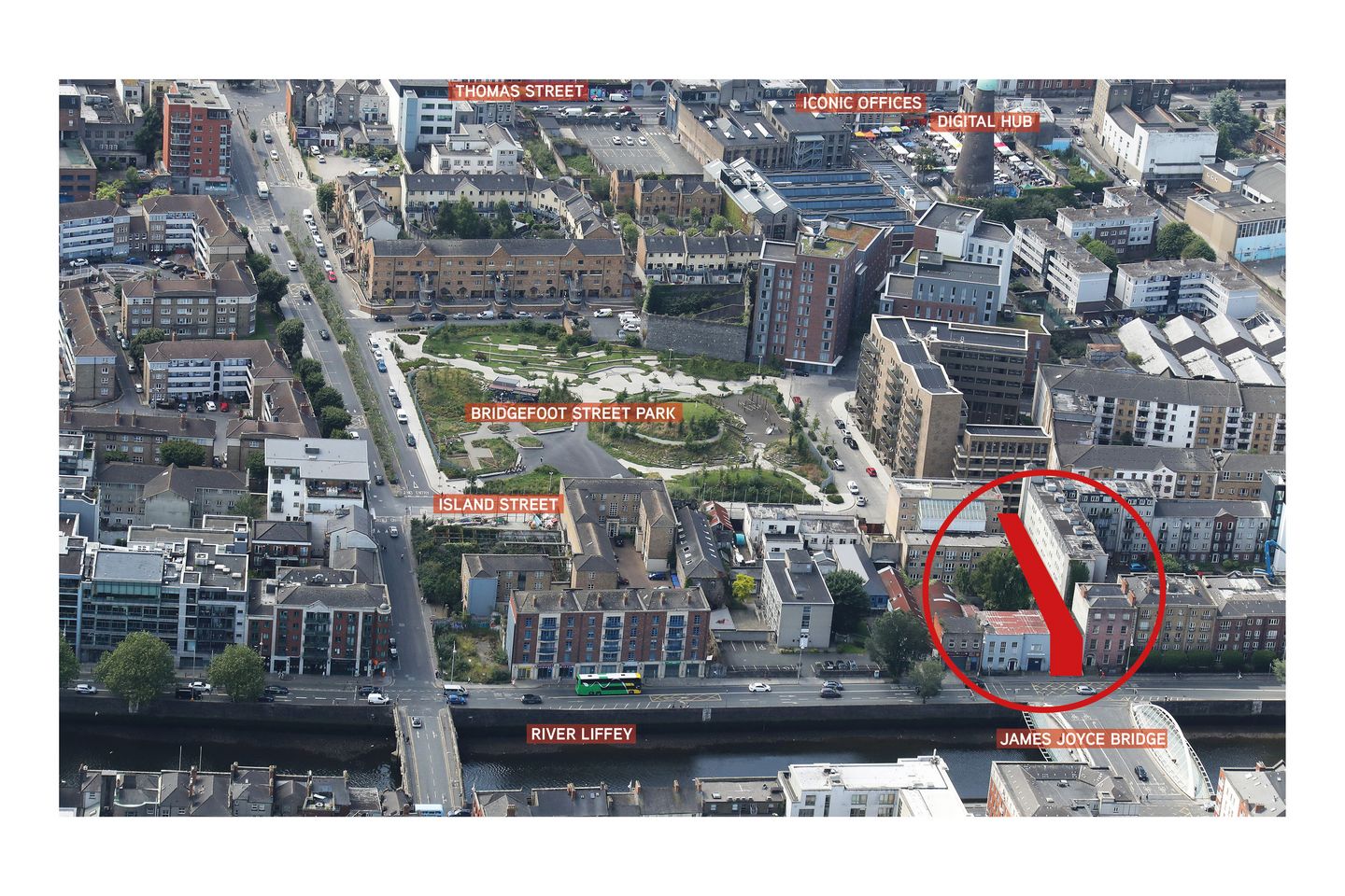
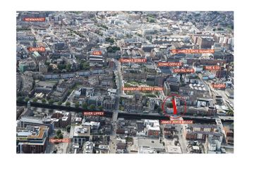
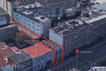
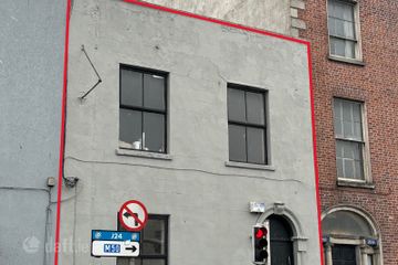
Key Features High profile development site overlooking James Joyce Bridge, The River Liffey and Blackhall Place Full Planning Permission in place for 10 apartments (previous planning permission for 15 apartments) Excellent city centre location within a short walking distance from Heuston Station, the LUAS and several bus routes along the quays and Thomas Street. The subject property is located a short walking distance from Thomas Street, Lidl and a host of shops, cafes, pubs and restaurants The new development overlooks the new Bridgefoot Street Park and is a short walking distance from the Digital Hub, Roe & Co. Distillery, Iconic Offices, Guinness Store House, Guinness Quarter, Guinness Enterprise Centre, Phoenix Park, Blackhall Place and the Four Courts Approx. 650 m from Heuston LUAS stop and Train Station Approx. 415 m from Benburb St./ Smithfield LUAS stations Approx 1.1 km from the Phoenix Park 1.3 km from St. James Hospital Approx 1.7 km from OConnell Bridge Location Number 14 Ushers Quay holds a high profile position on the south quays overlooking the James Joyce Bridge with panoramic views along the River Liffey with views up Blackhall Place to the north of the Liffey. The subject property is approx. 7 meters wide and extends 62 meters back to Island Street to the south of the property and overlooks the recently refurbished Bridgefoot Street Park, which opened in May 2022. The Bridgefoot Street Park is 2 acres in size and has been carefully landscaped and designed to benefit the local community with place making and meeting places. Number 14 Ushers Quay is located beside the House of the Dead which features in James Joyces The Dead, which has planning permission to be converted into a 54 bedroom hostel. This planning permission may be changed to accommodate 10 apartments SPP. The property is also within a short walking distance from Diageos - Guinness Brewery and Open Gate Brewery on James Street as well as St. James Gate Visitor Centre and Gravity Bar which has 1.1 million visitors a year. Diageo also run Roe & Co. whiskey Distillery and Visitor Centre on the north side of Jamess Street. 14 Ushers Island is located 100 meters from The Digital Hub which is a start-up centre for Irelands largest cluster of technology, digital media and internet companies. Some recent Digital Hub companies include Amazon, Stripe, Daft.ie, Havok and Riverdeep etc. Some of the other adjoining occupiers include St. Catherine's Church, Arthurs Pub, Pierce Lyons Whiskey Distillery and visitor Centre, Guinness Enterprise Centre, LIDL, Spar, Dealz, Vicar Street, the National College of Art & Design, Highlight Student Accommodation, HeyDay Student Accommodation. This area of Dublin has recently seen some strong regeneration and development in recent years including the Pearse Lyons Distillery and visitor Centre in St. James Church, Iconic Offices refurbishment of the IAWS Building, Digital Hub development of the Grain Store building and Binary Hub student accommodation. Other developments planned for the immediate area include the development of the 12.5 acre Guinness Brewery site into a dynamic urban quarter, consisting of 336 residential units, two hotels (with 304 beds and office blocks. Other developments planned for the area include the Grand Canal Harbour site by Marlet (nearing completion), Digital Hub phase 2 and development of 2 sites to the rear of Vicar Street for a boutique hotel. This is a very popular area for IT and design companies given the close proximity to the Digital Hub, Guinness Enterprise Centre and NCAD. The subject property is located in a very popular tourism District and is within 10 minutes walking distance from the Phoenix Park, Temple Bar and a host of popular cafes, restaurants and bars. Description 14 Ushers Quay comprises a 3 storey protected office building (RPS No. 8197) facing onto the quays. The property was originally in residential use and was built in 1750 as a Georgian house and comprises 2 storey over basement office building which has kept most of its period features. The property was originally 4 storeys but the top floor has since been removed. The property is in reasonably good condition and has been used as an office and recently a site office for Duggan Contractors. The entire site extends to approx. 62 meters and there is a large double height warehouse at the south of the site with vehicular access onto Island Street. There is a small courtyard area between the 2 properties. Some of the adjoining properties comprise 4 and 5 storey residential buildings and there are a large number of apartment developments in the immediate area including the Viking Harbour development. Planning Permission Full Planning Permission in place for 10 apartments from August 2020 (Ref 4252/19) Residential Units Studio Apartments 1 Bed Apartment 5 no. 2 Bed Apartment 1 no. 3 Bed Apartment 4 no. 24 Cycle Parking Spaces DCC Planning Permission contribution for reduced planning permission 64,496.71 euro payment Please note that the current planning permission does not cover short term letting use. The development comprises refurbishment of the existing 3 storey protected building facing the River Liffey plus new 2 storey and 6 storey blocks at the rear of the property with direct access to Island Street overlooking Bridgefoot St. Park. There could be potential to add 1 - 2 floors to the protected building facing the quays SPP. Existing Buildings Protected 3 storey Office Building 218.43 sq.m. (2,351 sq.ft.) Warehouse 276.63 sq.m. (2,978 sq.ft.) Zoning Objectives The site is zoned Z5 City Centre - To consolidate and facilitate the development of the central area and to identify, reinforce and strengthen and protect its civic design character and dignity. The primary purpose of this use zone is to sustain life within the centre of the city through intensive mixed-use development. The strategy is to provide a dynamic mix of uses which interact with each other, help create a since of community, and which sustain the vitality of the inner city both by day and night¦ Ideally, this mix of uses should occur both vertically through the floors of the building as well as horizontally along the street frontage. Permissible Uses Amusement/leisure complex, bed and breakfast, betting office, buildings for the health, safety and welfare of the public, car trading, childcare facility, civic offices, community facility, conference centre cultural, creative, artistic, recreational building, delicatessen, education, embassy office, Enterprise Centre, funeral home, guesthouse, home-based economic activity, hostel Hotel, industry (light), Internet café, live work units, media-associated uses, medical and related consultants, motor sales showroom nightclub, office, off-licence, open space, part off-license, place of public worship public house, public service installation, residential, restaurant, five technology-based industry shop (district), shop (neighbourhood), shop (major comparison), take away training centre area surgery, warehousing, (retail/non food)/retail park. A full information pack and planning permission file is available upon application Approved Scheme Summary: Apt. No. Description. Block. Floor: GFL SQ.M. Bike parking 1 2 Bed Duplex 3 G/1st 78.2 2.5 2 1 Bed Apt. 3 1st 49.9 1.5 3 3 Bed Apt 3 2nd 91.6 3.5 4 3 Bed Apt 3 3rd 91.6 3.5 5 3 Bed Apt 3 4th 91.6 3.5 6 3 Bed Apt 3 5th 91.6 3.5 7 1 Bed Apt 1 Ground Fl. 51.2 1.5 (Protected Structure) 8 1 Bed Apt 1 1st 60.9 1.5 9 1 Bed Apt 1 2nd 61.5 1.5 (Protected Structure) 10 1 Bed Apt 1 3rd 61.5 1.5 Total 10 7296 24
The local area
The local area
Local schools and transport

Learn more about what this area has to offer.
School Name | Distance | Pupils | |||
|---|---|---|---|---|---|
| School Name | St Audoen's National School | Distance | 590m | Pupils | 181 |
| School Name | Scoil Na Mbrathar Boys Senior School | Distance | 610m | Pupils | 129 |
| School Name | An Cosan Css | Distance | 700m | Pupils | 29 |
School Name | Distance | Pupils | |||
|---|---|---|---|---|---|
| School Name | Stanhope Street Primary School | Distance | 720m | Pupils | 400 |
| School Name | Georges Hill School | Distance | 760m | Pupils | 152 |
| School Name | St. James's Primary School | Distance | 780m | Pupils | 278 |
| School Name | Francis St Cbs | Distance | 810m | Pupils | 164 |
| School Name | Canal Way Educate Together National School | Distance | 850m | Pupils | 379 |
| School Name | St Brigid's Primary School | Distance | 980m | Pupils | 228 |
| School Name | St Gabriels National School | Distance | 1.0km | Pupils | 176 |
School Name | Distance | Pupils | |||
|---|---|---|---|---|---|
| School Name | The Brunner | Distance | 670m | Pupils | 219 |
| School Name | St Josephs Secondary School | Distance | 710m | Pupils | 238 |
| School Name | James' Street Cbs | Distance | 790m | Pupils | 220 |
School Name | Distance | Pupils | |||
|---|---|---|---|---|---|
| School Name | St Patricks Cathedral Grammar School | Distance | 1.1km | Pupils | 302 |
| School Name | Mount Carmel Secondary School | Distance | 1.1km | Pupils | 398 |
| School Name | Presentation College | Distance | 1.2km | Pupils | 221 |
| School Name | Belvedere College S.j | Distance | 1.7km | Pupils | 1004 |
| School Name | Synge Street Cbs Secondary School | Distance | 1.7km | Pupils | 291 |
| School Name | Larkin Community College | Distance | 1.8km | Pupils | 414 |
| School Name | Loreto College | Distance | 2.0km | Pupils | 584 |
Type | Distance | Stop | Route | Destination | Provider | ||||||
|---|---|---|---|---|---|---|---|---|---|---|---|
| Type | Bus | Distance | 160m | Stop | Sarsfield Quay | Route | 69 | Destination | Poolbeg St | Provider | Dublin Bus |
| Type | Bus | Distance | 160m | Stop | Sarsfield Quay | Route | X27 | Destination | Ucd Belfield | Provider | Dublin Bus |
| Type | Bus | Distance | 160m | Stop | Sarsfield Quay | Route | N2 | Destination | Clontarf Station | Provider | Go-ahead Ireland |
Type | Distance | Stop | Route | Destination | Provider | ||||||
|---|---|---|---|---|---|---|---|---|---|---|---|
| Type | Bus | Distance | 160m | Stop | Sarsfield Quay | Route | C5 | Destination | Ringsend Road | Provider | Dublin Bus |
| Type | Bus | Distance | 160m | Stop | Sarsfield Quay | Route | 860 | Destination | Aston Quay | Provider | Express Bus |
| Type | Bus | Distance | 160m | Stop | Sarsfield Quay | Route | C1 | Destination | Sandymount | Provider | Dublin Bus |
| Type | Bus | Distance | 160m | Stop | Sarsfield Quay | Route | X30 | Destination | Ucd Belfield | Provider | Dublin Bus |
| Type | Bus | Distance | 160m | Stop | Sarsfield Quay | Route | C4 | Destination | Ringsend Road | Provider | Dublin Bus |
| Type | Bus | Distance | 160m | Stop | Sarsfield Quay | Route | 4 | Destination | Monkstown Ave | Provider | Dublin Bus |
| Type | Bus | Distance | 160m | Stop | Blackhall Place | Route | N2 | Destination | Heuston Station | Provider | Go-ahead Ireland |
BER Details
Ad performance
- Date listed22/08/2024
- Views9,046
Daft ID: 519935881
