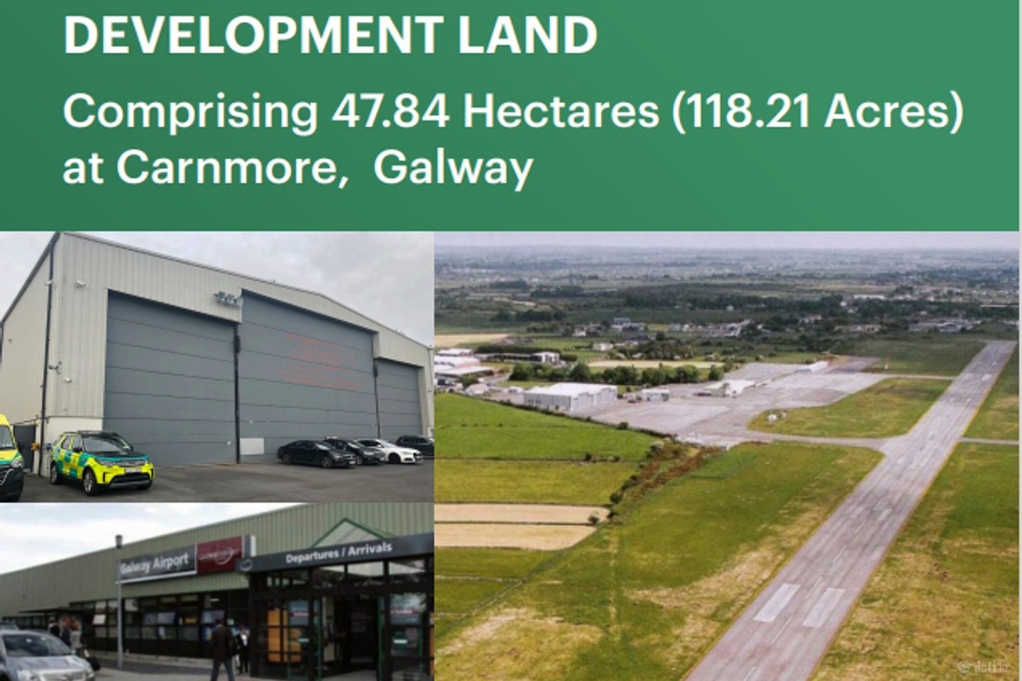

47.84 Hectares (118.21 Acres), Carnmore, Co. Galway
Price on Application
- Selling Type:By Private Treaty
- Available From:Immediately
About 47.84 Hectares (118.21 Acres), Carnmore, Co. Galway
Description
EXPRESSIONS OF INTEREST TO BE SUBMITTED BY 23RD MAY 2025 AT 5PM The subject property comprises of an overall site area of 47.84 Hectares (118.21 Acres). The existing buildings comprise 2 hangers and are constructed of similar galvanised steel cladding, metal purlins traversing the roof, galvanised roof, concrete floor, uPVC double glazed windows throughout the building over ground and first floor with single glazed wooden windows on the internal offices overlooking the hangers. Each hanger consists of an eave's height of approximately 11.7 metres and 3 rollers shutter doors to the front. The middle roller shutter door measures 11.322 m high x 15.446 m width and the doors to either side measure 8.420 m high x 8.155 m width. Each Hanger has the benefit of 3 automated roller shutter doors. There are 110 numbered car spaces to the rear of the hangers with a further 11 spaces number A to P, 3 of these spaces are marked disabled car parking. A stone boundary wall and steel fencing provide a boundary around the car park and rear and side of the hangers. The subject is located at Carnmore West, Co. Galway, being the former Galway Airport Site. Carnmore is located on the outskirts of Galway City located on the R339. The Eircode for the subject property is H91 E2W4. The Local Authority for the area is Galway County Council. The property has frontage onto the R339 Monivea Rd, the R381 Oranmore Road, and the L7106. The R339 connects with the R381 at Carnmore Cross providing direct access to Junction 19 M6 Galway to Dublin motorway at Oranmore only 1.2 km from the subject property. The M6 links directly to the M17/M18 motorways linking directly to Tuam and Limerick. Carnmore enjoys a prime location located between Galway City via the N6 Bothar na dTreabh. Claregalway 5km from the subject property and Oranmore 5.1 km from the subject property via the R381.
The local area of 47.84 Hectares (118.21 Acres), Carnmore, Co. Galway
Local schools and transport

Learn more about what this area has to offer.
School Name | Distance | Pupils | |||
|---|---|---|---|---|---|
| School Name | Brierhill National School | Distance | 2.6km | Pupils | 241 |
| School Name | Caremore National School | Distance | 3.2km | Pupils | 174 |
| School Name | Merlin Woods Primary School | Distance | 3.4km | Pupils | 383 |
School Name | Distance | Pupils | |||
|---|---|---|---|---|---|
| School Name | Scoil Mhuire Oranmore | Distance | 3.9km | Pupils | 471 |
| School Name | Scoil Íosa | Distance | 3.9km | Pupils | 743 |
| School Name | Gaelscoil De Hide | Distance | 3.9km | Pupils | 409 |
| School Name | Claregalway National School | Distance | 4.1km | Pupils | 313 |
| School Name | Claregalway Educate Together | Distance | 5.1km | Pupils | 220 |
| School Name | Castlegar National School | Distance | 5.2km | Pupils | 82 |
| School Name | Gaelscoil Dara | Distance | 5.5km | Pupils | 428 |
School Name | Distance | Pupils | |||
|---|---|---|---|---|---|
| School Name | Coláiste Mhuirlinne/merlin College | Distance | 3.4km | Pupils | 725 |
| School Name | Coláiste Bhaile Chláir | Distance | 3.7km | Pupils | 1315 |
| School Name | Calasanctius College | Distance | 3.8km | Pupils | 925 |
School Name | Distance | Pupils | |||
|---|---|---|---|---|---|
| School Name | Galway Educate Together Secondary School | Distance | 4.8km | Pupils | 350 |
| School Name | Galway Community College | Distance | 6.4km | Pupils | 454 |
| School Name | St Joseph's College | Distance | 8.4km | Pupils | 767 |
| School Name | Our Lady's College | Distance | 8.4km | Pupils | 249 |
| School Name | Coláiste Iognáid S.j. | Distance | 8.7km | Pupils | 636 |
| School Name | Coláiste Muire Máthair | Distance | 8.9km | Pupils | 765 |
| School Name | St. Mary's College | Distance | 9.0km | Pupils | 415 |
Type | Distance | Stop | Route | Destination | Provider | ||||||
|---|---|---|---|---|---|---|---|---|---|---|---|
| Type | Bus | Distance | 640m | Stop | An Carn Mór | Route | 425a | Destination | Galway | Provider | Bus Éireann |
| Type | Bus | Distance | 2.9km | Stop | Oranmore Station | Route | 351 | Destination | Galway | Provider | Tfi Local Link Limerick Clare |
| Type | Rail | Distance | 2.9km | Stop | Oranmore | Route | Rail | Destination | Athlone | Provider | Irish Rail |
Type | Distance | Stop | Route | Destination | Provider | ||||||
|---|---|---|---|---|---|---|---|---|---|---|---|
| Type | Bus | Distance | 3.0km | Stop | Briarhill Business Park | Route | 427 | Destination | Atu Galway | Provider | Burkesbus |
| Type | Bus | Distance | 3.0km | Stop | Briarhill Business Park | Route | 401 | Destination | An Phairc Mhor | Provider | Bus Éireann |
| Type | Bus | Distance | 3.0km | Stop | Briarhill Business Park | Route | 409 | Destination | Celestica | Provider | Bus Éireann |
| Type | Bus | Distance | 3.0km | Stop | Ballybrit Crescent | Route | 417 | Destination | Galway | Provider | Bus Éireann |
| Type | Bus | Distance | 3.0km | Stop | Ballybrit Crescent | Route | 401 | Destination | Dr. Mannix Road | Provider | Bus Éireann |
| Type | Bus | Distance | 3.0km | Stop | Ballybrit Crescent | Route | 409 | Destination | Celestica | Provider | Bus Éireann |
| Type | Bus | Distance | 3.0km | Stop | Coolagh | Route | 425a | Destination | Galway | Provider | Bus Éireann |
BER Details
Ad performance
- Date listed12/05/2025
- Views2,619
Daft ID: 521698676